This is a follow-up to my last posting, on the wanton destruction on the Stapleton runway tunnels over Sand Creek.
It wasn't supposed to happen!
In Friday's paper, at least in my neighborhood, Forest City included a copy of their quarterly magazine, Stapleton. They've been publishing this for four or five years now, from right about the time construction on the first neighborhoods began. The arrival of this magazine in my newspaper prompted some investigation.
I'll admit, I'm fascinated with the old airport. When I was a kid it meant Grandma was coming in from New York on TWA. When I grew older it meant that I was going somewhere on a jet plane. Now I'm watching Stapleton very closely, because from my earliest childhood I've always been fascinated with urban development. The only reason I ever got into Charles Dickens (I'm re-reading Bleak House right now, after last winter's wonderful Masterpiece Theatre adaptation) was because London was a central character in most of his novels. When I was in London, one of the books I found (and bought) was a book about the genesis and ongoing development of the Tube map. And I read it cover to cover.
Back to the investigation....
When the Stapleton Visitor Center first opened I dragged Matt out there to look at the expensive architectural models....and to buy a copy of "the Green Book." Officially called Stapleton Development Plan, the Green Book was published by the Stapleton Redevelopment Foundation in 1995, and reprinted by Forest City in 1999. I compared the map in the new issue of Stapleton with the maps in the Green Book, and I have to say, Forest City, in its initial development of neighborhoods immediately east of Quebec and north of Montview, did a better job than what the Green Book proposed. Of course, in 1995 it was all about finding ways to make this land an extension of Denver and Aurora neighborhoods, and the initial ideas were mostly boring grids. If you go out to Stapleton now, they used the grid, but far more creatively. There are some wonderful amenities.
But one thing that Forest City did that the Green Book didn't really suggest to be part of the redevelopment was to build an ungodly amount of retail space surrounded by blinding white concrete. If you go to Quebec Square, the Wal-Mart, Sam's and Home Despot-anchored power center that stretches from the United Airlines flight training center to Smith Road, you'll find a pretty unimpressive sea of parking, and a fairly unimaginative roster of national chain tenants (along with a number of vacant spaces). You could be in Aurora, or--Lark Ridge! (refer to my posting about Lark Ridge from last October or November). I hate Quebec Square. It really doesn't have anything to do with the Green Book's vision. Sure, that land was meant to be commercial--you wouldn't want to have houses fronting busy Quebec, or that close to I-70--but why did they have to make Quebec Square so damned ugly?
Then there's NorthField at Stapleton, an even bigger shopping complex north of I-70. As I mentioned previously, NorthField is anchored by Bass Pro Shops Outdoor World, a tourist trap for ignorant Bush voters (oh wait--that's a redundant phrase--all Bush voters are ignorant, therefore if you use the word "ignorant" in front of "Bush" you're merely repeating yourself).
Sorry...where was I? Currently open at NorthField, in addition to Bass, are a multiplex cinema, a Circuit City, and a SuperTarget. Under contruction--but physically separate from the line up of Bass, CC and ST--another sea of concrete being the transition zone--is a so-called "main street" of retail shops, anchored by Harkins on one end and Macy's on the other (in case you didn't know, Foley's is to be re-named Macy's by the fall of this year). The pedestrian-only "street" (think of the Village at FlatIron Crossing) is about two blocks long between the two anchors.
And that's not all! In the site plan published in Stapleton, the site will be symmetrical, meaning several more big-box anchors on the eastern edge of the site to balance Bass, et al., on the western edge--and of course separated from the other retail by lots and lots of parking. I realize that the northeast quadrant of the metro area is "under-served" (according to retail experts) compared to other parts of the metro area. After all, no one wants to build a Whole Foods in Commerce City--or a Barnes & Noble, or anything else for the educated and affluent. But this is absurd, AND it's poorly-designed. After the debacle of Quebec Square, I doubt Stapleton really will ever need this much retail space. It might be different if the whole area was surrounded by residential areas, but remember the vast Rocky Mountain Arsenal National Wildlife Refuge is across the northern boundary of old Stapleton, and there is a huge warehouse district to the east. Stapleton will have 30,000 residents at full build-out, but I predict they'll go to Cherry Creek for their retail needs, not wanting to deal with the gridlock around Bass Pro Shops. While there are plans to build residential neighborhoods on the Stapleton land immediately south of the arsenal, there won't be enough population to support all this. There just won't.
But why am I ranting about NorthField? Because it's not supposed to be there, according to the Green Book. The Stapleton Master Plan of 1995 shows a lovely diagonal open space running southwest to northeast across the northern part of the old airport, connecting Sand Creek to the Arsenal. It's labelled "Sandhills Prairie Park," and while it's not a formal Olmsted-esque city park, it's nevertheless meant to be natural and open, allowing wildlife to move freely from refuge to creek. And NorthField is right in the middle of it! In other words, there is no "Sandhills Prairie Park," or if there is, it's not going to be contiguous with the wildlife refuge. The only aspect of NorthField that remains "natural" is the pond next to Bass Pro Shops--and that's not much.
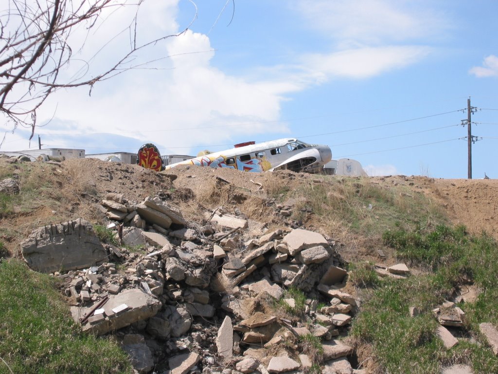
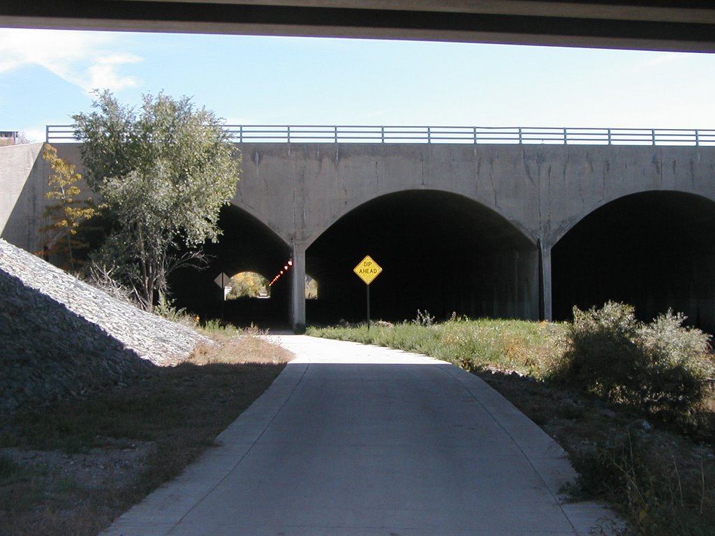
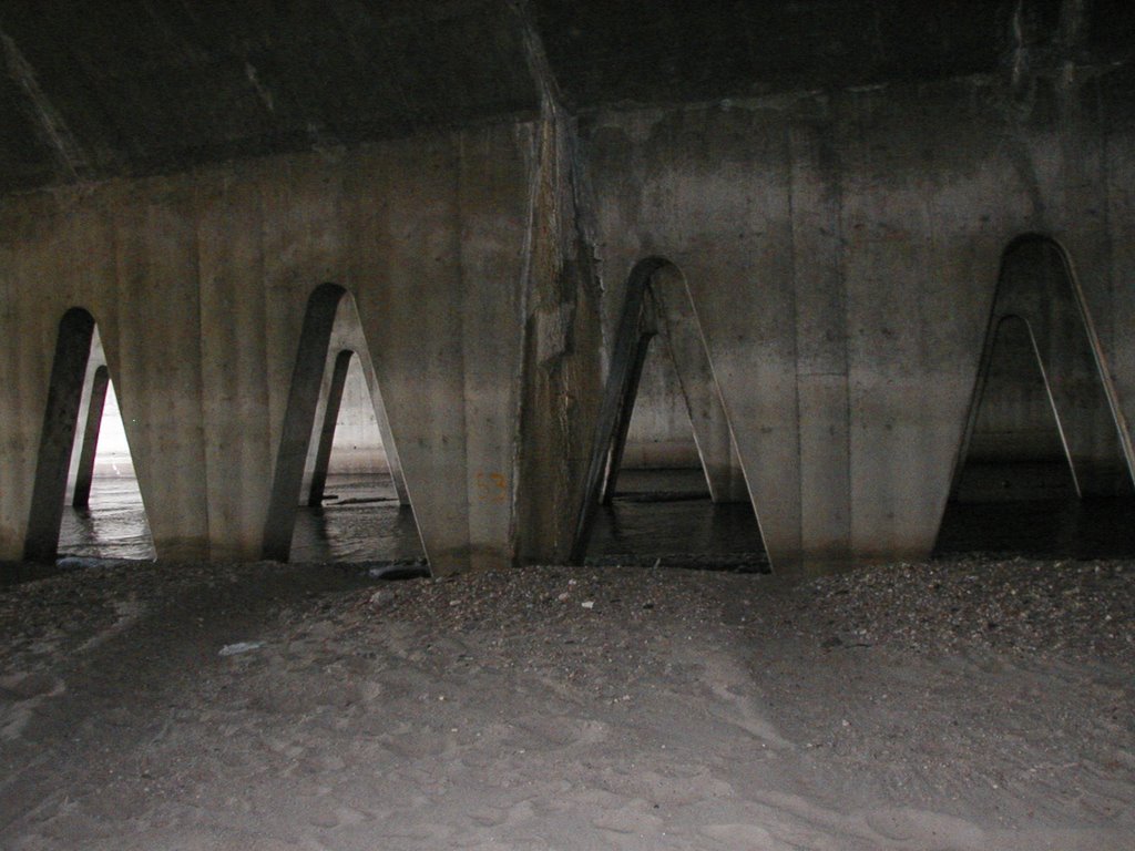
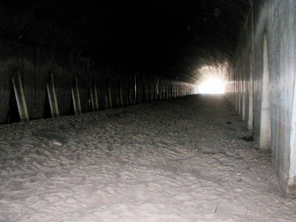
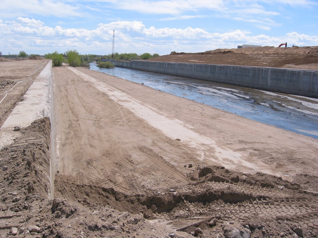
But the original point of this posting isn't the unnecessary amount of retail. It's the tunnels. The thing is, they were supposed to remain. Maybe not as tunnels, but as something. On page 5-22 of the Green Book (the book is divided into sections, hence the odd pagination) there's a lovely pencil sketch of the Sand Creek Trail, with concrete structures bisecting the creek. Caption: "The existing runway tunnel structure could be opened up with the arched wall elements remaining for historical interest."
Yes, that's a "could," and the Green Book was meant merely to guide development, not absolutely dictate everything. But still, what a shame. Denver re-used the interesting concrete structures of the old municipal sewage plant at the South Platte and Franklin (just southwest of Riverside Cemetery), incorporating them as sculptural elements in the boringly-named new park known as "North Park" that very few people (save graffiti artists, dog trainers and cyclists) seem to know about. Check out that park (via car, you can go north on Washington from I-70, and cut over on one of the side avenues a few blocks north of the freeway), and imagine what might have been at Stapleton.
 It starts as you come around the curve on 14th Avenue. There's this shape looming up over the Bach Wing of the Denver Art Museum.
 And then there you are.